


Typhoon Fung-Wong, the 26th storm of the Pacific season, reached super typhoon status on November 9, with sustained winds of up to 52 meters per second (185 km/h). As of 14:00 local time, its center was located approximately 275 kilometers east of Manila, the Philippines, moving west-northwest toward Luzon Island.

The storm is projected to make landfall along eastern Luzon by the evening of November 9, weakening slightly as it crosses the island. By midday on November 10, it is expected to enter the South China Sea as a typhoon, regaining strength to potentially reach severe typhoon intensity. Meteorologists note a shift to a north-easterly track by November 11, with a likely second landfall along southwestern Taiwan Province on November 12 before rapid dissipation.
The Central Meteorological Observatory of China has issued warnings for persistent gales and heavy rainfall from November 9 to 14. Key affected sea areas include the South China Sea, Bashi Channel, and Taiwan Strait, where winds may reach Force 12–14 near the storm's core, with gusts of up to Force 15–16.
From November 10 to 13, heavy rain is forecast for Zhejiang, Fujian, and Guangdong, with Taiwan's eastern coast expecting extreme totals of 250–400 mm, locally exceeding 600 mm. Authorities have advised residents in vulnerable areas to monitor updates, adjust travel plans, and prepare for potential flooding and landslides. Maritime operations have been suspended, with vessels urged to return to port.
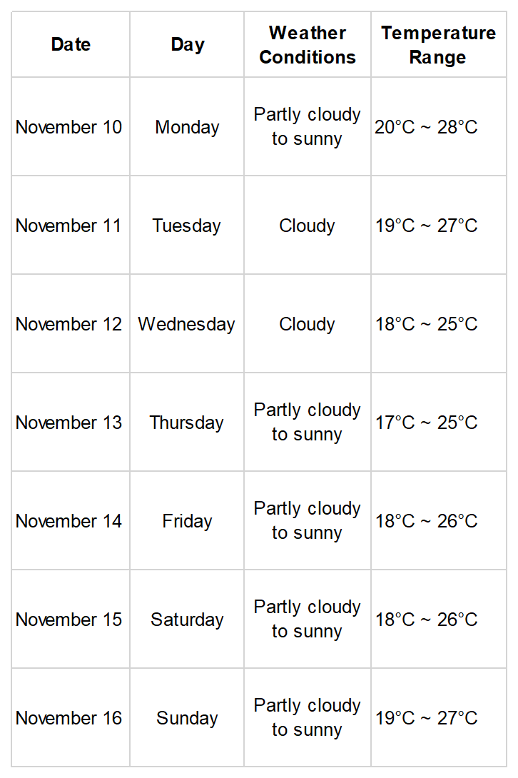
7-Day Weather Forecast for Guangzhou
Author | Feng Huiting
Photo | Nanfang Daily
Editor | Ouyang Yan, Wei Shen, James Campion, Shen He